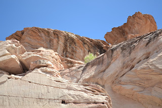
Today we took a 3 hour cruise on Lake Powell visiting Antelope and Navajo Canyons and along the Colorado River. We finished back at Wahweap (means bitter water in Navajo) National Park. The weather is a nice 82 degrees. The canyons were filled to the end of the white line in 1983 on the pictures. Since then the level has been lower. It took 17 years after the Dam was finished in 1957 to fill these canyons. Amazing. It provides water to Utah, Arizona and I think some of California. It is the second largest Dam next to the Hoover Dam which is 16 ft. more. The scenery is moving. The rocks are formed by layers of sand petrified over time with winds and water. The pictures are lots of rocks. At one point the canyon got very narrow. Just amazing. The view is provided by a little bit of man's utilizing the Colorado River to bank water in dry times and God's awesome creativity in forming this planet we call earth.
 |
| Our boat for the tour. |
 |
| Wahweap Marina |
 |
| Mrs. Dillon with her headset on for tour information. |
 |
| White is where the water level was. Navajo Canyon. |
 |
| Navajo Canyon |
 |
| Navajo Canyon |
 |
| Navajo Canyon |
 |
| Mother Nature's artwork. |
 |
| Mr. Dillon enjoying the tour via headset. |
 |
| Antelope Marina with amazing boats for playing. How the other half lives. |
 |
| Antelope Point Marina |
 |
| Leaving Antelope Point |
 |
| Entering Antelope Canyon. |
 |
| Antelope Canyon, very narrow. |
 |
| Plateau |
 |
| Narrow Antelope Canyon |
 |
| Some of the greenery that grows out of rock and sand. |
 |
| Sun behind brings out the deep rich red color of rust which is magnesium oxide. |
 |
| Looking up at the sky, Antelope Canyon walls narrow. |
 |
| Many colors of rock. |


